Appearance
Topological Terrain Analysis with TTK
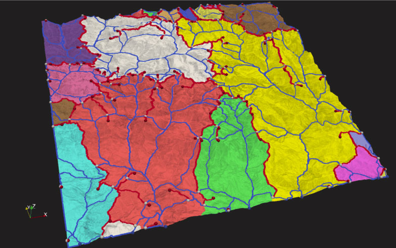
Topological analysis of terrain elevation is crucial for surface water workflows, such as estimating water runoff zones. This analysis allows for the identification and classification of critical points like peaks and pits, the segmentation of watershed boundaries, and the highlighting of ridges and valleys. These elements are essential for understanding the terrain's structure. In the accompanying figure, colored regions indicate areas feeding into the blue river network, while red paths denote ridges.
For more information, see Practical Use Cases for TTK.
Frameworks used: ParaView, TTK